Territorial disparities in mobility
December 2023
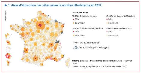
The transition to sustainable, low-carbon mobility depends heavily on the regional context. Indeed, the various territories have contrasting situations in terms of mobility, on which depend the drivers to implement levers of sobriety. To analyse these territorial disparities and define a typology of territories, LA Banque des Territoires refers to INSEE’s latest territorial classification, namely city catchment areas, which follows on from urban areas.
The catchment area of a town is a group of municipalities, in one piece and without enclave, which defines the extent of the influence of a population and employment centre on the surrounding municipalities, this influence being measured by the intensity of commuting.
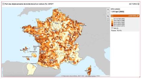
Next, to characterise the mobility habits of residents, we use an indicator, the modal share of the car in home-work journeys. This indicator represents the proportion of working people who travel mainly by car to work, according to their place of residence. This figure is a good approximation of a region’s dependence on the private car. It also determines the sobriety levers appropriate to the area.
The table below details the modal share of car use for home-work journeys according to the functional territorial status of the municipality, based on the zoning of urban catchment areas. In other words, depending on whether or not the municipality belongs to an urban catchment area, and if so, how large it is, and on its status within this catchment area (centre municipality, pole municipality, municipality in the catchment area, etc.).
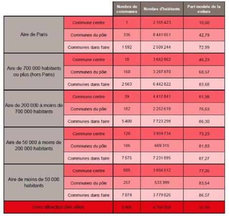
Some interesting observations:
-
For all the catchment areas, the modal share of the car increases the further one moves away from the centre of the area. This clearly shows that car use varies according to distance from the city centre.
-
The smaller the catchment area in terms of number of inhabitants, the greater the modal share of the car in home-to-work journeys, for all types of municipality (centre, hub, area) compared with each other.
-
The most surprising result is that dependence on the car is greater in peri-urban areas, i.e. in municipalities located in catchment areas but outside the centres, than in rural areas, i.e. municipalities located outside the catchment areas of cities (with the exception of the Paris peri-urban ring).