PAP 80: Oléron, landscapes in the background
Patrick Moquay, November 2024
Le Collectif Paysages de l’Après-Pétrole (PAP)
A major tourist destination, the island of Oléron is a fragile territory that has been faced with strong tourist and urban development for several decades. Since the beginning of the 21st century, this ‘positive energy island’ has been committed to a policy of sustainable development that is as demanding as it is creative. An article written by Patrick Moquay, professor in the Human and Social Sciences department of the École nationale supérieure de paysage. He was mayor of Saint-Pierre d’Oléron and president of the Communauté de communes de l’île d’Oléron from 2008 to 2014.
To download : article-80-collectif-pap_pm-.pdf (8.6 MiB)
The development of Oléron, the largest Atlantic island in mainland France, is strongly influenced by tourism. The landscape is therefore at the heart of the island’s planning and development strategy, even though it is rarely mentioned explicitly by those involved. In fact, the island’s appeal is essentially due to the variety and quality of its landscapes, recognised and protected by their classification in 2011 under the Sites Act 1. These landscapes have been shaped by the activities that ensured the subsistence of the local population. An island of farmers rather than sailors, Oléron has nevertheless been able to take advantage of its maritime character by exploiting coastal resources through fishing on foot rather than on board ships, and also by exporting its produce, particularly to England, to which the island belonged for four centuries. Two emblematic landscapes have been established here over time: on the vast agricultural plateau in the centre and north, a flourishing wine-growing industry flourished, particularly before the phylloxera crisis; former sea bays, gradually filled in and turned into marshes, were developed from the Middle Ages onwards to harvest salt, then converted into oyster-farming ‘claires’ from the 19th century onwards. A third characteristic landscape was created during this period: the state-owned forests, planted mainly with maritime pines, developed by the authorities to fix the sands of the seaside.
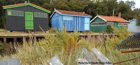
Most of the villages are located on the limestone plateau that forms the island’s bedrock from south to north. The main towns were established there rather than on the seashore - the wisdom of the ancients, who were wary of the proximity of an uncertain and shifting shoreline. Only the hamlet of La Perroche, the seat of a medieval priory, had settled on the shore in the hope of facilitating trade. The market town of Château d’Oléron, which was the main port of access to the island, is also close to the shore, but the dwellings are concentrated on a sheltered hilltop. As for La Cotinière, today a dynamic fishing port that took off at the end of the 19th century, its original village was located some distance from the shore, behind a thick dune belt. However, many hamlets have sprung up in low-lying areas, close to the marshes that were their source of wealth, a situation that today exposes them to the risk of flooding. Interspersed with a regular grid of villages and hamlets that give structure to the agricultural area and its estates with their fine 18th and 19th century residences, these great landscapes have been somewhat disrupted by the rise in tourism.
At the beginning of the 20th century, this boom, linked to the attraction of the sea air and the sun, was based on two resources, as Saint-Trojan, at the southern tip of the island, still testifies today 2. Following in the footsteps of major seaside resorts such as Royan, on the nearby Gironde estuary, middle-class villas were built for summer holidaymakers. Based on hygienic principles, establishments dedicated to the prevention or treatment of respiratory diseases were successively built: sanatoriums (1896), aériums and préventoriums in the 1920s, mainly for working-class children 3. Health care was soon to take on a social dimension. During the inter-war period, mostly Communist local authorities bought up the buildings of large agricultural estates across the island that had been ruined by phylloxera. They set up holiday camps. This movement took off in the 1930s and reached its peak after the war with around fifty establishments. It was to determine the future of tourism on the island. Many of the children who had discovered Oleron at holiday camps would return as adults, or even move there for retirement. This was the beginning of the social tourism that marked the island’s identity. The popular clientele benefited from the advent of paid holidays and the widespread use of camping. This led to three key developments: the development of commercial campsites (the tourist office counts 81, with a total of more than 36,400 tourist beds); the sale by farmers and landowners of small plots of land ‘for camping’ on the least productive land, which was often flooded in winter; and the purchase of second homes, which led to a property boom from the 1970s onwards.
The island’s sociology evolved as a result of these demographic and land market changes. In the post-war period, the arrival of second-home residents and retirees from modest backgrounds (often employed by companies and public services) marked the advent of popular tourism. With soaring property prices, reinforced by the health crisis of 2020, the last few decades have seen the arrival of a more affluent clientele.
The first landscape intervention tools
Strong growth in tourism led to a spectacular expansion of urbanisation in the 1980s and 1990s. Most of this development was in the form of detached houses, as Oléron had long been wary of collective housing programmes, including tourist residences 4. Although town planning regulations were implemented early on 5, the north-west coast of the island has become mired in a continuous fabric of housing, with villages surrounded by housing estates. This seemingly unstoppable trend led the government to protect a large classified site from urbanisation, encompassing the island’s still vast agricultural and natural areas. At the same time, local authorities have gradually become aware of the value of these natural and agricultural areas and the landscapes they offer, which form the basis of the island’s tourism development. This has led to the introduction of a number of policies to control and regulate construction, as well as a number of developments.
In the same spirit of harmonisation and quality improvement, the CCIO has drawn up principles for the development of public access areas. In 2006, a ‘beach plan’ assessed the spirit and use of bathing areas according to their degree of naturalness, and determined the appropriate level of facilities. In 2007, the ONF was commissioned to draw up a development charter, which was to become the ‘Oléron coastal quality’ charter. These development principles were subsequently applied to all seaside tourist areas. The guidelines adopted limit the amount of waterproofing on the roads, develop extensive parking facilities for bicycles, give preference to wooden furniture and propose templates for public information panels. These principles also apply to services (beach surveillance, water sports, etc.). Dry toilets have been installed to avoid having to connect sites that are far from the mains. Finally, as soon as the risk of erosion became apparent, particularly on the ocean coast, car parks were moved back - sometimes by several hundred metres - and the number of parking spaces reduced. On the other hand, the use of bicycles has increased spectacularly, in response to a significant effort to provide the necessary facilities.
Preferring travel that respects the site
It was not a foregone conclusion. Tourists visiting the island had been asking for cycle paths since the 1980s, but the island’s elected representatives showed little interest in the subject. Oléron was an island ‘for cars’, an emblem of freedom and paid holidays. In the 1990s, the departmental council became alarmed at the fact that Oléron was lagging behind in terms of cycling facilities, while the neighbouring island of Ré was already making cycling a sign of its quality of life. It took the initiative of creating a meandering route from the south to the north of Oléron, to link the main sites it owns as sensitive natural areas. The result was the Bicycle Plan I, ratified by the island’s elected representatives in 1995, who entrusted the Communauté de Communes with the construction and maintenance of the cycle paths. This was followed by Cycle Plans II (2004) and III (2012), which gradually provided a virtually complete network of cycle paths around Oléron - the final sections to fill in the gaps around the island are currently under construction. There are now more than 150 km of trails in a variety of environments, along roadsides and in woods, at some distance from cars where possible, or sometimes crossing natural areas in peace and quiet. There are still more direct sections for utilitarian uses such as work or shopping, for which some people are reluctant to accept detours that guarantee peace and safety. Cycling’s success is reflected in a relative easing of traffic congestion, but also at the cost of overuse of cycle paths, leading to fears of an increase in accidents and conflicts between cyclists.
Cycling is not the only way to reduce the number of cars on the island. As part of the development of the local authority’s Agenda 21, launched in 2008 and approved in 2011, a comprehensive travel plan has been launched, aimed at deploying a range of alternatives. In addition to cycling and encouraging car-pooling, the CCIO has supported public transport. On land, a summer ‘beach shuttle’ service was introduced in 2010 to link the main accommodation sites to the markets and beaches, with a financial contribution from partner hotels and campsites. From the second year onwards, the local councillors opted to make the service free of charge, which significantly boosted visitor numbers. In 2016, they got the departmental council 6 to delegate responsibility for the bus services to them, which led to better coordination of public transport on the island of Oléron. The unified service, renamed the ‘summer shuttle’, now offers a range of travel solutions that enable people to stay on the island without a car, but only during the peak tourist season, much to the chagrin of some residents. At sea, with the support of the La Rochelle conurbation and the département, the communauté de communes has set up a sea link between La Rochelle and Oléron, landing at Boyardville. Taking over from a private initiative that failed to make a profit, this service operates from April to October, with four daily departures at the height of the season. The fifty-minute boat trip is quicker than the car or bus journey, and offers an unforgettable view of the departure and arrival sites.
Learn to live with coastal risks
Storm Xynthia in February 2010 reminded the people of Oleron that the island nature of the region means that it is highly exposed to coastal risks. Villages on the edge of marshland are exposed to flooding, which is exacerbated by rising sea levels. Erosion, meanwhile, threatens a large part of the one hundred and ten kilometres of coastline. Regular and gradual on the small cliffs in the north, it is variable but sometimes spectacular on the sandy coasts. At the southern tip of the island, in an uninhabited area that has historically been reclaimed from the sea, the dunes are currently retreating by twenty metres a year.
Since the mid-1970s, the Charente-Maritime department has been responsible for building protective structures such as dykes and riprap. Since 2007, an agreement has been in place between the CCIO and the department: the latter carries out the work, then transfers the structures to the community, which manages them. The Xynthia storm, followed by the introduction of the Gemapi (aquatic environment management and flood prevention) remit in 2020, have reinforced this role for the intermunicipality. The development of the first flood prevention action plan (PAPI) for the Ile d’Oléron, validated in 2012 following the Xynthia warnings, was an opportunity to affirm the community’s doctrine: reinforcing protection around urbanised areas; taking into account dune belts as part of ‘diking systems 7’; experimenting with soft methods in natural areas; using marsh areas to absorb and attenuate flooding. The local coastline management strategy, approved in 2021, reaffirms these principles.
A rural area to be developed
Drawing up Agenda 21 for the Ile d’Oléron was an opportunity to formalise a roadmap for community policies. With the creation of a department dedicated to economic development in 2008, the CCIO affirmed its desire to support primary activities, which are primarily responsible for land use and therefore for developing and maintaining the island’s landscapes. To this end, a committee for sustainable agriculture on Oléron was set up in 2011, with representatives appointed by the island’s farmers and professional bodies. In 2012, this committee defined and adopted the agricultural charter for the island of Oléron, which forms the basis of the Communauté de Communes’ policy in this area. This involves an exhaustive diagnosis, with a survey of each of the island’s farms (around a hundred) to identify their projects and difficulties. Financial support is provided for conversion to organic farming - a move already underway by young winegrowers and market gardeners. In addition, a community land policy has been put in place, supporting farmers in their search for land and creating a fund for the acquisition of agricultural plots. In this way, the communauté de communes plays the role of long-term land operator, a role that was no longer fulfilled to any great extent by the SAFER 8. Since 2015, this policy has been extended to include the revival of salt production, and support for projects to rehabilitate salt marshes. Lastly, a number of initiatives have been launched to promote local produce, including the award of the Vignobles et Découvertes label in 2014 and the organisation of annual Agricultural Days with farm visits and conferences.
The exceptional nature of the island’s natural environment has led to a number of protective measures being taken, with the Charente-Maritime department and the Conservatoire du Littoral intervening to protect the land. Having set up its natural areas management service, in 2014 the CCIO was entrusted with maintaining the properties of these two institutions. From 2020, as part of its Gemapi remit, the department will also be responsible for managing vast areas of marshland.
The issue of agricultural wasteland lies at the junction of the community’s agricultural policy and its policy for managing natural areas. The right balance needs to be struck between recultivation, which cannot be systematic, and maintaining a mosaic of environments conducive to biodiversity. A training course devoted to this issue led to the creation of the Atlantic Islands Agricultural Network (RAIA), which enables farmers and local authorities to share their experiences.
A positive energy island
The Community of Communes is actively committed to a policy of energy transition. As early as the late 2000s, the first initiatives in this area encouraged the installation of energy-efficient heating systems (solar heating, pellet stoves, heat pumps) by awarding grants to private individuals. For their part, the community’s facilities were intended to be exemplary in terms of insulation and energy production. The Iléo aquatic centre, begun in 2003 and inaugurated in 2009, is heated by a wood-fired boiler fuelled by untreated waste collected by a specialist waste management company, while photovoltaic panels supply part of its electricity consumption. From 2011, the CCIO has been supporting the installation of photovoltaic panels on private homes and public buildings, with this production being systematically incorporated into new community projects. In 2015, it demonstrated its ambition by joining the network of positive energy territories, with the aim of the island producing as much energy as it consumes by 2050. The DREAL, which initially opposed the installation of any photovoltaic panels on roofs within the listed site, still had to be convinced. While a citizen photovoltaic production company (Oléron sous le soleil - OSS17) was set up in 2018, the community of communes and several municipalities are committed to the creation of a collective self-consumption photovoltaic production cooperative. This project will require changes to the regulations, as the distances between production and consumption sites - once the project covers the whole island - exceed the maximum values set out in the legislation. In addition, as early as 2015, the local authorities undertook to reduce night-time lighting, which has enabled the island to regain its starry skies.
The local debate on renewable energies has been marked in recent years by plans to build offshore wind farms off the coast of the island of Oléron. The island’s residents and elected representatives are very divided on this issue. Public consultations on the project have led to the site being moved more than 40 km away from the island’s coastline. This will significantly reduce the project’s impact on the seascape, but the distance will mean that the local authorities will not be able to benefit from the financial windfall that some had hoped for. And, in a Natura 2000 area reputed to be a major migration corridor, the question of the project’s impact on bird ecosystems remains. This huge project is beyond local control. It is not taken into account in the energy objectives of the communauté de communes.
The future of an island
Being an island naturally calls for an awareness of the limited nature of local resources, and therefore of the area’s extreme dependence on its neighbours on the mainland. Drinking water supplies, for example, are largely provided by off-island sources, as the local water tables are no longer sufficient to supply the island’s population, which increases tenfold in summer, and are under constant threat of seawater ingress due to over-exploitation. Although awareness of these vulnerabilities is slow to develop, it is likely that the fact that the island is an island, both geographically and in terms of its identity, now makes it easier to define ambitious transition strategies. The local authorities in Oleron have committed themselves to an active policy of sustainable development, for which the landscape, as a real and symbolic territorial base, is a discreet but driving force. The community of communes has acknowledged the importance of these landscape issues by recruiting a landscape designer in 2021, who will support local authorities in their projects to redevelop public spaces. Although the quality of the landscape is only explicitly - and often vividly - invoked during various development controversies, the issue of landscape remains fundamental to both the identity of Oleron and its island policies.
-
1 The listed site on the island of Oléron covers more than 84% of the island’s land area.
-
2 Sylvine Pickel, Un tourisme « durable » à Saint-Trojan-les-Bains, de 1860 à 1999 ?, mémoire de DEA environnement, temps, espaces, sociétés, université d’Orléans, 1999.
-
3 Over the decades, the health establishments in Saint-Trojan have evolved towards the care of the disabled, for which Saint-Trojan still has two major medical centres dedicated to the care of children and adults.
-
4 This can be seen as a trace of the island spirit, both individualistic and resistant to institutions or even rules…
-
5 The island’s communes have had land use plans since the 1970s, and the first master plan for the island of Oléron was drawn up by the State in 1973.
-
6 At the time, it was the organising authority for inter-urban transport, a responsibility that has since been transferred to the regions.
-
7 At the cost of a tug of war with the State, which only intended to take into account ‘hard’ protection, and in fact only agreed to fund the latter.
-
8 The SAFER only acquires land if it has already identified a buyer. The CCIO, on the other hand, acquires derelict plots with a view to eventually reconstituting viable landholdings. It can make the land available under a rural lease, or sell it to an interested farmer.