PAP 70 - Reclaiming the quality of urban peripheries : proposals from the landscape atlases of Catalonia
Pere Sala, October 2023
Le Collectif Paysages de l’Après-Pétrole (PAP)
This Signé PAP article is a continuation of the text by Pere Sala, director of the Observatori del Paisatge de Catalunya, translated by Enric Salvans-Roussel. The text deals with peripheral areas, using Catalonia as an example. It discusses the proposals of the Catalan Landscape Atlas for improving the quality of life. This text is taken from the book « Franges. Els paisatges de la perifèria », collective work edited by Joan Nogué, 350 p. 2012. Collection « Plecs de paisatge » No. 3.
To download : article-70-collectif-pap_ps2-.pdf (19 MiB)

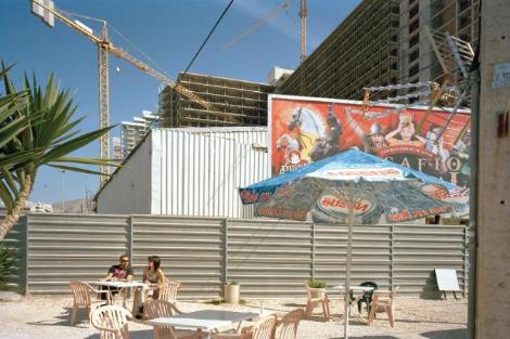
From ignored fringes to claimed fringes
While art, literature and, more recently, the cinema have been effective mediators in transforming the way we look at landscapes and developing our awareness of them over time, the landscapes of the peripheries, where thousands of people live, have, until recently, been little represented here by literature, art, cinema, music or the media. This is not the case in other parts of the world. American cinema, for example, has helped to create an image of apparent anarchy in fringe landscapes around the world. Abandoned factories, crumbling buildings, wastelands lost in the middle of motorway bypasses have become, in the movies, perfect places to traffic drugs or plan assassinations. Certain fringes are routinely depicted as places where anything can happen. This view has reinforced - or helped to create - many prejudices about the urban fringe as ignored, anonymous, singular and even dangerous places, forcing planners to try to rethink or reformulate these media images. As few of our own writers, artists and film-makers have engaged with the landscape of the periphery, it is a fact that this territory, which has been intensively transformed over the last few decades, remains little known and little appreciated. This lack of interest helps to widen the gap between the mythical images of the Catalan landscape, the reference landscapes forged by literature and painting, and the reality of the peripheries, the Catalan landscapes of the early 21st century that are the daily living environments of hundreds of thousands of people.
Spirit of place and fringe
A transformation as abrupt and rapid as that which has taken place in certain peripheral landscapes affects the character of places and must have repercussions on the sense of belonging of those who live there, that bond of identity, culture and even emotion which forms the basis of our existence. We might wonder whether these rapid transformations of peripheral spaces do not affect the security that comes from recognising ourselves in a familiar place, causing disorientation, anxiety and a feeling of being uprooted. In some fringes, it is increasingly difficult to find the identifying features of a landscape. A study of the perceptual references of the inhabitants of the Barcelona metropolitan area shows that the inhabitants of the big city mention the typical places of their urban landscape, while the inhabitants of the villages evoke mainly agricultural elements and mountains. For their part, those living in suburban areas paradoxically refer to the most mythical figures of the city centre - Sagrada Família, Montserrat… - urban landscapes that are well known to most of them, but that have little to do with the places where they live. The imaginary landmarks by which these residents represent the space around them are therefore marked by a profound conflict of representation and meaning. How can people living in suburban residential areas be made to feel emotionally attached to them? However, it has been observed that in the more recent suburban neighbourhoods, some residents identify certain characteristic features such as blocks of buildings, underpasses at transport hubs or warehouses, expressing a greater sense of familiarity with these recognisable elements of their daily space than with the centre of the city where they live. Projects such as the restoration of the market-garden plains of Salt and Santa Eugènia are very important in rebuilding spatial polarities that enable people to find their bearings and identify with their surroundings, as they help to rebuild a collective sense of belonging to the place and help the community to feel that it is its own property. These plains, which have been redeveloped in favour of agricultural activity, have contributed to a remarkable social, productive and cultural reactivation, in parallel with an improvement in the urban and environmental quality of the surrounding area. These processes have been reinforced by the participatory involvement of local residents in management and decision-making. In recent years, Barcelona, Manresa, Mollet, Olot, Sabadell and La Seu d’Urgell have launched similar initiatives.
Emerging landscapes on the outskirts
The construction of new transport infrastructures is giving rise to another type of landscape phenomenon on the outskirts of cities. The landscape atlases of the Girona, Hautes Pyrénées and Val d’Aran regions describe, for example, how the rapid development of bypasses around towns has led to a change in the visual environment for motorists, as the routes now avoid the town centres. The characteristic facades that are often heritage features have disappeared in favour of other perceptions, creating a new imaginary landscape for both the resident population and those who are just passing through, relegating the urban core and its historic quality to a certain degree of indifference. Another emerging landscape is that of interstitial micro-spaces, spaces that have emerged in the midst of the proliferation of infrastructure caused by urban growth. In Catalonia, there has been an increase in the number of these spaces that have been abandoned or are awaiting a different future. This phenomenon spoils the image of the city’s outskirts, as their proximity to mobility infrastructures makes them highly visible, encouraging the establishment of marginal uses such as illegal crops, illegal dumping sites or improvised parking. Many spaces of this type will remain as they are, while others could be redeveloped if we intervene creatively to implement more comprehensive structuring solutions for the city. In this respect, we might mention the initiatives that have been successfully applied in Holland, which have created nature reserves in different landscapes, including interstitial ones, to reinforce their landscape identity or invent a new one, for example by forming small ponds to accommodate wildlife. The fringes are extremely versatile, since the temporary hosting of facilities or events such as circuses, concerts, camping areas or concentrations of caravans can temporarily transform them, changing the landscape, its values and how it is perceived.
How can all the pieces of the jigsaw be represented?
Maps tend to make what they represent official, truthful and irremovable, which means that you have to pay close attention to what is shown and how it is shown. A prerequisite for mapping is to have objective information on which to base operational decisions. But mapping the periphery and everything that happens there is extremely difficult. How can we give shape to the changing and highly mobile dynamics that are specific to these areas? Can the hybrid, versatile and ephemeral characteristics of the fringes be represented on a map? How can we depict the disruption to visual harmony caused by the siting of certain warehouses in areas of high landscape quality, or the new identities that are emerging on these fringes? As the landscape atlases were being drawn up, one thing became clear. Our methodology has tested its own limits. To represent a reality as complex as the landscape of the fringes, it will probably be necessary to replace conventional mapping systems with other media capable of capturing these emerging landscapes, such as photography, art or the immense possibilities offered by new technologies, otherwise we will not be able to interpret the landscape properly, or take the right decisions.
The key role of peri-urban agriculture
The agricultural areas that surround towns and cities help to shape their identity. Although their purpose is economic, and they are used primarily for productive purposes, these areas should nonetheless play a key role in the management, planning and restructuring of the urban fringes of the future. We need to ensure that the network of agricultural areas is as extensive and as unfragmented as possible. As a bridge between the rural and urban worlds, peri-urban agriculture provides solutions for consumers who are increasingly concerned about food quality and safety. In Catalonia, the Bas Llobregat agrarian park and the Gallecs rural park in Vallès Oriental are benchmarks in these areas. Let’s not lose sight of the fact that what is at stake today in the outlying areas is the fate of the fertile soil of the plains, much more than that of the forest, which, on the whole, is gaining ground here every year. Agricultural areas should also be seen as privileged allies when it comes to complementing the classic tourist products of snow, sun and beach. In the Priorat and Penedès regions, for example, people have become aware of the added value provided by a typical, well-maintained landscape. Bordering urban centres, the system of open spaces formed by river systems, natural areas and peri-urban agriculture acts as a green lung close to the cities. The landscape diversity of these areas helps to recharge the water table and protect against natural hazards. The future lies in further reinforcing these green belts, such as the green - and eminently forested - ring in the Barcelona metropolitan area, the Vallès greenway, and the green rings in Girona, Vic and Manresa; it also lies in restoring deteriorated areas and improving access conditions so that citizens can enjoy these places and get involved in safeguarding the area.
Multifunctional and efficient fringes
Peripheral areas are not just places where various uses accumulate or simple transition zones between a centre and an increasingly urbanised countryside, they have become a landscape in themselves, a landscape that fulfils multiple ecological, economic, social, historical and aesthetic functions. The various activities that take place there should be able to combine in a beneficial way and develop synergies. Here’s an example: a project planned to install wind turbines in areas of great scenic interest in the Haut-Empordà. After studying the potential and requirements of the area and assessing its energy potential, various local institutions came to an agreement that favoured locating the wind farm around the infrastructure corridor through which the state road II, the AP-7 motorway and the high-speed line pass 1. This initiative avoided the installation of wind turbines in areas where they would have been even more visible, and therefore less well accepted by the population. It was also proposed that all the municipalities affected should benefit. Initiatives of this kind are not common enough. They help to achieve territorial efficiency and contribute to energy self-sufficiency, which should be a strategic priority. Our landscapes now need to be involved in global challenges to ensure maximum security while controlling the impact on the landscape as much as possible.
Towards ephemeral, mouldable fringes
Perhaps we should think of the fringes as ephemeral, mouldable realities, and approach intervention in these places from this assumption. Perhaps it would be a mistake to apply the same solid, compact concepts used to design the city centre. If a building located in these peripheral spaces ceases to be functional and no longer makes sense in a new environmental, economic or technological scenario, should we not agree to eliminate it and replace it with another with new functions? If a city’s boundaries have been fenced off with low-density industrial or commercial zones, what happens when the city needs to expand or improve in quality? Will these areas need to be made denser, or will they need to be built over? The solution probably lies in inventing concepts and instruments that are much more flexible than those to which we are accustomed, in order to design more personalised peripheries, where the ephemeral as well as the reversible will prevail.
Making historical traces visible
To maintain the identity of peripheral landscapes, it is essential to understand their links with the past. Knowledge of mineral deposits, canals, aqueducts and irrigation ditches, mills and forges, land parcels, farms, transhumance routes and paths, inventories of historic monuments and consideration of the relationships that have existed between these elements over time can provide numerous avenues for urban and regional planning on the fringes. It is very important to identify, document and map these traces in certain landscapes which, as mentioned above, are often illegible at first glance. The PaHisCat (Paisatge Històric de Catalunya) pilot project was born precisely to take account of the fundamental role that the heritage elements in question have - or could have2.
The fringes can cease to be a place where externalities accumulate
In order to restructure and requalify urban fringes, we need to rely on a dual phenomenon. On the one hand, the capacity of urban cores to integrate urban externalities that the city traditionally relegates to its periphery and which occupy valuable fertile soil. One of the clearest examples of this is the construction of the Besòs wastewater treatment plant under the Plaza del Forum in Barcelona. We also need to take into account the capacity of the urban elements on the outskirts to accommodate infrastructures and services that are more typical of the rural world, and which until now have also been scattered over the valuable land on these same outskirts. One example would be to prioritise the location of photovoltaic parks on the roofs of existing or future buildings, such as business parks or commercial warehouses.
Delimiting the city
Once elements of the periphery have been imported into the city, further dispersal must be avoided and the principle of surrounding the city with walls must be metaphorically rediscovered in order to clearly define its contours. The main concerns of the citizens who took part in drawing up the Landscape Atlas of the Barcelona Metropolitan Region were the disappearance of agriculture, the poor quality of the surroundings and the loss of identity of the urban centres and their surroundings. We need to put some order into this landscape mess and make a clear commitment to compactness that respects the principle of a clear divide between the city and its rural surroundings, establishes urban development in continuity with existing urban grids, respects historical traces and prevents the loss of new fertile land.
A quality periphery, a competitive factor
It is important to consider the fringes as areas of opportunity, bringing value to both towns and their rural environments. Economic value, starting with agriculture, leisure, cultural consumption, transport and energy production. In the current context of a globalised economy and the resulting growing competition between regions, the quality of the landscape and its uniqueness are two decisive factors of attraction, particularly for businesses in the most advanced sectors (technology, information, innovation, etc.) as well as those in the leisure and cultural sectors. Here, the quality of the landscape acts as a factor of competitiveness and sustainable development. Hence the need for each location to identify its most distinctive features.
Integrated, high-quality projects
A landscape must be able to accommodate a new element that is inserted into it without the new element taking over the character of the landscape and destroying its coherence, whether physical or functional. In other words, we need to be able to transform landscapes without them losing their identity. In areas on the fringes of metropolitan areas, we need to promote initiatives capable of reviving the memory and identity of the place, in agreement with the local population. Aesthetic in essence, this sensitive approach must go beyond the cosmetic, ornamental or simply formal character that often dominates certain interventions, and aim to recover the vitality of the landscape itself, a vitality that is as much physical as it is economic, social and atmospheric. Projects of very different nature and function, such as the Besòs river park (Sant Adrià de Besòs), the project to recover the river space of the Llobregat (Bas Llobregat), and the library, park and farm of Can Llaurador (in Teià) are magnificent examples of such approaches. Today’s suburbs need such well-integrated, high-quality projects, capable of giving meaning and character back to suburban areas that have become commonplace. Well-thought-out, well-executed and well-managed landscape projects can have a catalytic effect on other similar landscapes that have so far been left waiting for answers.
Recycling landscapes
In the urban fringes adjacent to the former power stations and factories that give industrial areas their look of desolation and exhaustion, we are seeing more and more cases of facilities that have taken on a meaning for the local population and are beginning to be valued as an element of local identity. One example is the profile of the chimneys at the Sant Adrià de Besòs power station, which has become a symbol of the central-northern area of the Barcelona metropolitan region. One of the initiatives that consolidated the role of this old thermal power station as an icon for the Barcelona metropolitan area was the referendum that the city council organised in 2009 among the city’s residents on whether to maintain the power station or demolish it after it ceased operating. The result of the vote was clearly in favour of keeping the plant. Examples such as these raise the question of whether certain artefacts scattered around the country should not be considered as heritage assets, and whether preference criteria should be defined. The current trend in Europe is for less and less time to elapse before an item is considered heritage. The debate would become more complex if we were to broaden our gaze to include other features built during the twentieth century, such as bridges, roads, railway lines and greenhouses, as is beginning to happen in other countries.
Educating people about the fringes
One of the key issues in promoting awareness and understanding of the landscape in areas that are generally not highly valued by the general public is to educate the eye. This would be a non-conditioned, non-directed form of education, with the aim of increasing people’s awareness that the fringes carry meaning and values, that they can be improved, and that this improvement can make a positive contribution to people’s quality of life. All too often in our country, the contemplation of the landscape is associated with the search for the spectacular or the singular, in other words with scenographic values, which leads us to overlook the landscapes of the periphery, which are perceived as less attractive. Yet twenty-one of the more than four hundred viewpoints listed in landscape atlases are located in peri-urban areas. These views make them easier to understand: for example, the view from Sant Pau hill, in Bellaterra, or from Sant Ferran castle, in Figueres. More than eighty are visually oriented towards these spaces (such as the viewpoint from the sanctuary of Queralt, in Berga, and that from Eramprunyà castle, in Gavà), and almost fifty routes defined in the atlases also cross spaces of this type. The landscape atlases of Catalonia show that one of the many ways of achieving a perception of the value of the peripheral landscapes is through the routes and viewpoints that invite, stimulate and facilitate perception and reflection on urban and rural landscapes. It is a perception that is not exclusively visual, but also emotional and intimate.
A strategic challenge
By virtue of their very development and the number of human beings who inhabit them, the peripheries are a type of landscape that we need to reflect on and act upon because of the major role that these landscapes now play in structuring the territory, its balance and its economy. This will require a substantial change in the spatiotemporal scale to which we are accustomed, and an understanding that today’s social and symbolic referents, including landscapes, are changing at great speed. However, the current situation of global uncertainty demands that policies for the fringes are not only expected to adapt to a given state of reality, but also to anticipate it. We are immersed in global change, in which the fringes, by virtue of their powerfully dynamic and changing nature, will play a dominant role.
-
1 In February 2010, the Alto Empurdà Mayors’ Council approved the study « Territorial planning for wind farms in the Alto Empurdà », promoted by Figueres City Council, the Alto Empurdà County Council and the Girona County Council for Local Environmental Initiatives (CIL-MA), and drawn up by the Cerdà Institute.
-
2 The PaHisCat project is the result of collaboration between the History Department of the University of Lleida, the Department of Territory and Sustainable Development of the Generalitat of Catalonia and the Observatory of the Landscape of Catalonia. The PaHisCat team is led by Jordi Bolòs, professor of medieval history at the University of Lleida. Focusing on the historical evolution of Catalonia’s landscape, this project aims to understand and disseminate the traces of the past that are still visible today in four of Catalonia’s one hundred and thirty-five landscape units (Conca de Poblet, Horta de Pinyana, Terraprims and Vall Cerdana).