Val d’Ancœur: participatory mapping at the service of territorial identity
June 2019
To implement the Val d’Ancœur landscape plan, the Melun Val de Seine Urban Community and the Brie des Rivières et Châteaux Community of Municipalities have mobilised the full range of consultation mechanisms. The participatory map is a guiding thread in this process. It is a tool for collectively defining the evolution, preservation and enhancement of landscapes. It makes it possible to rethink the way in which regional planning is conceived by placing the landscape at the heart of projects.
Areas of intervention
Ile-de-France
Seine-et-Marne
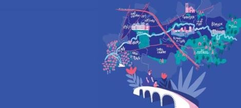
Two EPCIs in the Seine et Marne region have set out to turn a remarkable landscape into a lever for territorial development. The Melun Val de Seine Conurbation Community and the Brie des Rivières et Châteaux Community of Communes have joined forces to make, recognise and promote the Val d’Ancœur. A geographical entity, recognised by the departmental atlas of the department’s landscapes, articulated around a river, a valley and punctuated by several remarkable places, protected areas and castles. « The project emerged during the elaboration of the National Interest Contract with the State and the Department. A landscape plan makes it possible to address all the issues (mobility, living environment, ecology, animation) and to anticipate the consequences of an increase in the number of visitors to our territory, » explains Sandra Del Rio, head of the sustainable development department at CA Melun Val de Seine. The project was accelerated by an application to the State’s call for « landscape plans » projects, with the CA acting as lead partner to carry out the project. In total, the Val d’Ancœur landscape plan covers an area of 56 km², 11 municipalities and 61,000 inhabitants.
One day for a shared territory
This project is marked by the assertion of a territorial identity, as most of the inhabitants have little awareness of the wealth, assets and specificities of their territory. Their full involvement in the project was therefore fundamental. It also had to be multifaceted in order to reach all the stakeholders. An advisory board, divided into three working groups (mobility and infrastructures, environment and water, heritage and animation) brings together institutional and associative actors. The association of the general public then took several forms. The event « Once upon a time in the Val d’Ancœur », organised on 19 May 2019 in 10 locations and six municipalities in the area, made the richness of the area visible, via photo exhibitions or events such as painting workshops. It was also an opportunity to present the main stages of the approach: shared diagnosis, definition of objectives (2019) and action plan (2020). Thematic workshops then enabled a panel of around thirty inhabitants to explore several subjects: the natural and water landscape, the inhabited landscape, the agricultural landscape, and mobility. Finally, the two EPCIs wished to mobilise the schools through workshops organised with the leisure centres because « this young generation will be the first to experience the Val d’Ancœur ». An educational kit is also being prepared for distribution to all schools.
A participative map throughout the project
The event on 19 May was an opportunity to launch the project website www.planpaysage-valdancoeur.fr and its participatory platform. For a project aiming at consolidating a territorial identity, a participative card was naturally imposed and was integrated into the specifications (cost: 16,000 euros). Designed by the company « Fais la ville » and IMEDIA with the support of the SENSOMOTO landscaping team, the platform aimed to broaden consultation by allowing anyone to participate without having to travel for a meeting. Via a user-friendly interface, everyone could (anonymously) geolocate a project or point out, with a photo in support, gaps or places to be developed in a dozen predefined themes, comment on the ideas of others and vote for them. Open for five months, the platform had 57 registered users, 85 opinions and 59 votes at the end of October 2019. While these figures may seem modest, they complement the information collected during the workshops. The platform will also serve as a platform for consultation on targets and actions until 2020.
-
9,924 visits
-
57 registrants
-
85 notices posted
-
59 votes
Project support structure
« Fais la ville » and IMEDIA with the support of the SENSOMOTO landscaping team.