The city of the South in real time, the usefulness of aerial photography under kite in urban studies
Nouakchott, MAURITANIA
Armelle Choplin, 2014
Centre Sud - Situations Urbaines de Développement
This fact sheet presents the interest of aerial photography under kite for urban studies, and in particular for cities in the South that are experiencing rapid growth. This technique is being tested in Nouakchott (Mauritania) to compensate for the lack of up-to-date cartographic data.
How to capture the cities of the « South » whose reality changes from hour to hour? How to account for the almost daily advance of urban fronts while the maps made locally are often of poor quality and hardly updated, due to lack of resources? Aerial photography under kite offers a tool likely to provide some answers to these questions since it allows a coverage in « real time » .
Within the framework of an impact study carried out for the ONG GRET, we used this flexible and inexpensive tool. The study was to assess the urban transformations induced by the Twize program in Mauritania. This program was intended to facilitate access to permanent housing for the populations of the slums of Nouakchott. Modules of 20 m2 were built and financed by micro-credits.
See the city of EN HAUT ! to understand the dynamics from below. The meeting with the collective « En Haut ! » which experiments with aerial photography under kite in Mauritania has allowed to report on urban transformations.
Method chosen :
-
Overflight of the neighborhood (up to 200 m) and shooting where the program has intervened
-
Selection of photos and map work
-
In situ verification of the status of the occupant (owner, beneficiary of the program)
-
Calculation of urban transformations.
UMR PRODIG CNRS 8586 and « En haut ", Nov 2008
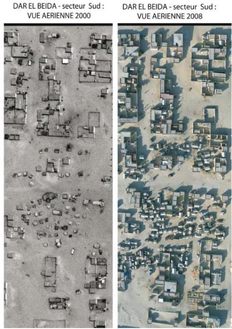
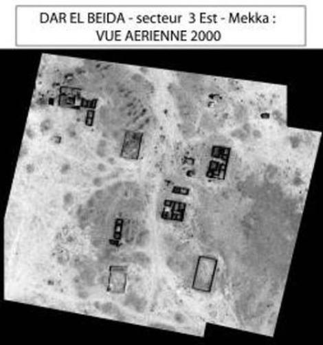
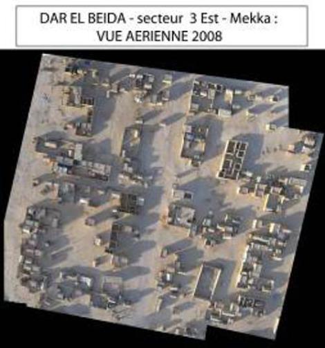
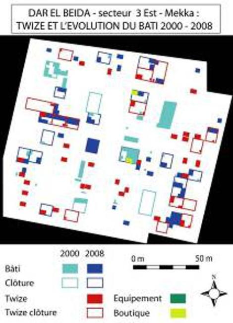
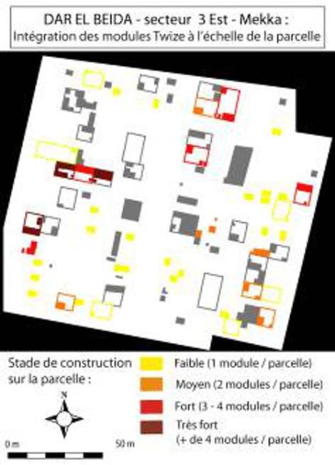
Example of urban transformation: the case of the Dar El-Beïda district
Located in the extreme south of the capital, this neighborhood has only recently been developed. Residents, who initially lived in a slum in the city center, were resettled there in 2006. The construction and the densification were thus done in a relatively short period of time (2006-2008).
After verification and calculation, the photos allow us to say that, in two years :
-
the constructions were multiplied by 5,
-
the number of plots built has increased by 8 and the number of modules by 6,
-
58% of the plots have benefited from the program.
The images also show that following the construction of a first module, individuals tend to continue the construction (adding rooms, latrines, kitchen…). For some beneficiaries, the Twize program has been a starting point for better living conditions.
Sources : UMR PRODIG CNRS 8586 and Collective « En Haut ! ", all rights reserved
Urbanization, precarious housing and speculation
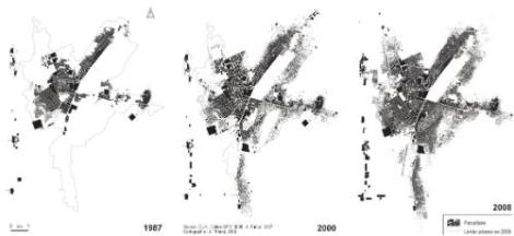
Nouakchott was created ex-nihilo in 1957 to become the capital of the Islamic Republic of Mauritania. Yesterday a simple town of a thousand inhabitants surrounded by dunes, it now has nearly a million people. If Nouakchott was not very attractive at first, it has experienced extraordinary growth since the 1970s. Following a period of severe drought, rural people without resources flocked to this urban center. All the urban planning is undermined while the former nomads set up their tents in the heart of the urban fabric. Progressively, bidonvilles (locally called kebbe) are formed.
In 1974, faced with the massive influx of people, the authorities took the initiative to distribute free housing lots. This led to a process of speculation and illegal occupation (called gazra). This phenomenon is observed in all neighborhoods and is practiced indifferently by all segments of the population hoping to obtain plots. Since then, the urbanization front has not stopped advancing. The State is not a mere spectator of the gazra but initiates this practice by regularly distributing plots of land. This allows it to attract a clientele and provides important revenues.
In the district of Dar El-Beïda, the squatters have installed shacks in the southern zone, waiting for a future distribution of land.
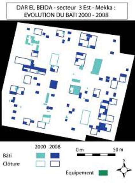
Mapping and image processing : B. Bosselut, November 2008.
Cartographie et traitement image : B. Bosselut, novembre 2008.
Cartographie et traitement image : B. Bosselut, novembre 2008.
Sources
Armelle CHOPLIN (Geographer, MCF Université Paris-Est) Collective « En Haut ! ", Aerial photography by kite, Bosselut B., Broquère M., Choplin A., Nancy S., 2009, « La ville du Sud en temps réel ", EchoGéo, n°9
Choplin A., 2009, « Nouakchott au carrefour de la Mauritanie et du monde », Paris, Karthala, 367 p.